Isolation Peak is aptly named: far from any trailheads, it seems
to be seldom climbed. The approach from the eastern side is from
Wild Basin, about 13 miles south of Estes Park.
|
I decided to camp below Bluebird Lake, about 5.5 miles from the
trailhead, in order to get an early start. I got a permit for the
Upper Ouzel Creek campsite, which the ranger said is the prettiest
in the area. Located above the trail in a stone perch, with the
steep slopes of Copeland Mountain and a small waterfall across
the valley, it is indeed a lovely site. The Indian Paintbrush
and Columbine flowers are spectacular this year.
I leave the trailhead at 16:34, pass
Ouzel Falls (2.7 miles from trailhead)
at 17:46,
and arrive at the campsite about 20:00, getting to bed at 21:30.
I am camping light, using an OR "standard" bivy sack and ultra-light
synthetic bag rated at 40 degrees.
|  |
|
There are a few light sprinkles of rain during the night, but the
bivy sack keeps me quite dry. When the alarm goes off at 5:30, it
is sprinkling -- not a good sign, and I turn off the alarm and go
back to sleep. I awaken again at 7:00; it is no longer sprinkling,
but foggy. This may not be a good day to hike. I decide to get up
and get going, hoping the fog will burn off. After eating, breaking
camp and filtering water, I'm on trail at 8:40
and arrive at Bluebird Lake at 9:00.
From Bluebird Lake, the route ascends a slope to the north, over
fairly steep and often loose talus, to a relatively flat bench.
Cairns mark a reasonably good route to the top. There are a lot
of dense nasty bushes on top of the bench. The best
way to avoid the bushes is to head to the west, directly down
toward the creek flowing from Pipit Lake toward Bluebird Lake.
Two small clearings are linked and lead to the creek area, which
is free of the dense bushes; then follow the creek up toward
Pipit Lake. Although last winter had a light snowfall and
many mountains are now free of snow,
the cirque between Ouzel Peak and Isolation Peak
(one route to the top) still has quite a bit
of snow. I am planning to go up the other way, via Isolation Lake.
|  |
|
From the Pipit Lake area, I head up to the right, reaching Isolation
Lake at 11:30. From here there is an obvious route up to the saddle
between Isolation Peak,
and Mahana Peak, then up the ridge to the summit.
I decide to go up directly toward the summit, over fairly steep but
mostly stable talus, though I ultimately go to the right of the summit
and have to traverse back left along the ridge to reach it.
Weather is beginning to threaten, but I am so close that I hate to
leave without reaching the summit. The traverse doesn't seem to take
long, and I reach the summit at 13:30.
|  |
|
There is a PVC pipe for the
summit register, but no register, just a Ziploc freezer bag containing
several slips of paper. In contrast to what I found on McHenry's Peak
last week (a sopping-wet summit log), the Ziploc bag has done its job
and the papers are pristine and dry. Although I didn't count entries
in the summit log, it appears that this peak is not climbed often
(perhaps a dozen times per year). I sign my name on a slip of
paper, snap a few photos, and get off the summit quickly to avoid any
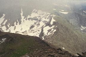
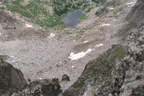
lightning. There are some dramatic views to
Isolation Lake, to the
south ridge of Isolation Peak,
and especially to the
west down to Fifth Lake, which has
some angular rock formations. There is a steep drop-off on the west
side of Isolation Peak.
|  |
 |
 |
I head down and to the left towards the saddle between Isolation and
Mahana Peak. I had planned to climb Mahana too, but the weather looks
threatening and clouds are moving in that are lower than the summits.
Mahana will have to wait for another year.
I reach Bluebird Lake at 16:15 and make a cell phone call to my wife.
This point has a fairly direct line of sight to Allenspark. On top of
Isolation Peak, the cell phone reached another system that was
decidedly unfriendly and refused the call. I continue down the trail,
not very fast at this point, and reach the trailhead at 19:15.
From Ouzel Falls on the previous day until returning all the way
to the trailhead, I haven't seen a single human being. If you want
solitude, it starts just a few miles from the trailhead. This has been
a memorable trip to a beautiful and isolated wilderness area.


